


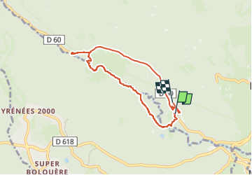

13,3 km | 19,3 km-effort

Gebruiker


Gratisgps-wandelapplicatie
 SityTrail
IGN / Geografische instituten
SityTrail World
De wereld gaat voor u open
Tocht van 7,3 km beschikbaar op Occitanië, Pyrénées-Orientales, La Llagonne. Deze tocht wordt voorgesteld door fb30.
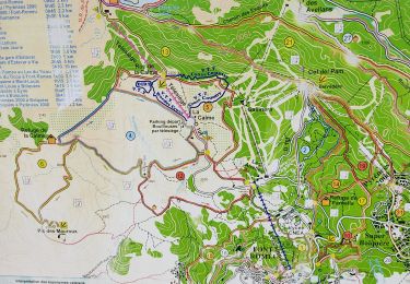
Petite balade sympa au bord de la rivière


Stappen

Sneeuwschoenen

Stappen

Stappen

Mountainbike

Stappen

Stappen
Stappen
Stappen